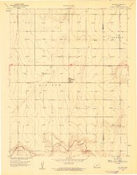
1959 Map of Big Bow
USGS Topo · Published 1960About this map
The unincorporated community of Big Bow stands as the central hub of this High Plains landscape, situated along the Atchison Topeka and Santa Fe railroad line. Surveyed in the late 1950s, the map reveals a region defined by its industrial transition, where traditional section lines are densely punctuated by numerous Gas Wells. This distribution indicates the significant development of the Hugoton Gas Area during this period, overlaying the agricultural grid of Western Kansas. The topography is largely level, though the southern portion of the quadrangle is etched by the drainage of Sandy Arroyo Creek. Local governance and land divisions are clearly marked through the township boundaries of Sherman, Big Bow, and Sullivan, providing a detailed look at the cadastral organization of Stanton and Grant Counties.
Find a feature on this map
9 named features on this map. Tap any name to fly to it.
Don’t see what you’re looking for? This feature index may not catch every label — zoom into the map to look around manually.
Map Details
Editions of this 1959 Big Bow Map
This is the sole edition of this map. No revisions or reprints were ever made.
Other maps of this area

1891 · Larned
USGS Topo · 1:125,000

1900 · Syracuse
USGS Topo · 1:125,000

1900 · Lakin
USGS Topo · 1:125,000

1920 · Syracuse
USGS Topo · 1:125,000

1955 · Dodge City
USGS Topo · 1:250,000

1958 · Dodge City
USGS Topo · 1:250,000

1959 · Dodge City
USGS Topo · 1:250,000

1959 · Ulysses NW
USGS Topo · 1:24,000

1959 · Big Bow NE
USGS Topo · 1:24,000

1959 · Big Bow NW
USGS Topo · 1:24,000