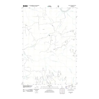
2011 Map of Big Cedar
USGS Topo · Published 2011About this map
Tahoe and Big Cedar are the primary settlements in this Idaho County landscape, which is defined by the steep drainage basins of the Clearwater River system. The northern boundary is marked by the Middle Fork Clearwater River, while the southern reaches are intricately carved by the South Fork Clear Creek and West Fork Clear Creek. This geography creates prominent landforms such as The Horn, Potato Hill, and Crane Hill, which dictate the winding paths of rural roads like Big Cedar Rd and Crane Hill Rd.
Find a feature on this map
35 named features on this map. Tap any name to fly to it.
Don’t see what you’re looking for? This feature index may not catch every label — zoom into the map to look around manually.
Map Details
Editions of this 2011 Big Cedar Map
This is the sole edition of this map. No revisions or reprints were ever made.
Other maps of this area

1924 · Weippe
USGS Topo · 1:125,000

1931 · Buffalo Hump
USGS Topo · 1:125,000

1934 · Buffalo Hump
USGS Topo · 1:125,000

1956 · Elk City
USGS Topo · 1:250,000

1956 · Hamilton
USGS Topo · 1:250,000

1959 · Hamilton
USGS Topo · 1:250,000

1960 · Elk City
USGS Topo · 1:250,000

1960 · Hamilton
USGS Topo · 1:250,000

1962 · Pilot Knob
USGS Topo · 1:24,000
1963 · Corral Hill
USGS Topo · 1:24,000