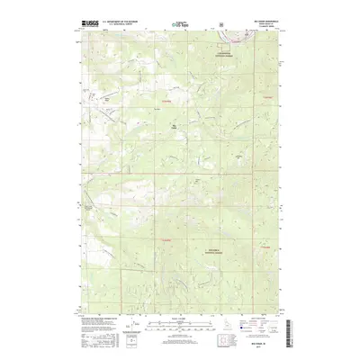
2017 Map of Big Cedar
USGS Topo · Published 2017About this map
Tahoe and Big Cedar occupy a landscape defined by the intersection of the Clearwater National Forest and Nez Perce National Forest. The 2017 survey reveals a network of forest development roads and specialized infrastructure, including the Clear Creek International Airport positioned along the southern drainage of Clear Creek. Settlement patterns are concentrated along high ground, with Tahoe Ridge and Crane Hill providing geographic orientation for the local road system.
Find a feature on this map
59 named features on this map. Tap any name to fly to it.
Don’t see what you’re looking for? This feature index may not catch every label — zoom into the map to look around manually.
Map Details
Editions of this 2017 Big Cedar Map
This is the sole edition of this map. No revisions or reprints were ever made.
Other maps of this area

1924 · Weippe
USGS Topo · 1:125,000

1931 · Buffalo Hump
USGS Topo · 1:125,000

1934 · Buffalo Hump
USGS Topo · 1:125,000

1956 · Elk City
USGS Topo · 1:250,000

1956 · Hamilton
USGS Topo · 1:250,000

1959 · Hamilton
USGS Topo · 1:250,000

1960 · Elk City
USGS Topo · 1:250,000

1960 · Hamilton
USGS Topo · 1:250,000

1962 · Pilot Knob
USGS Topo · 1:24,000
1963 · Corral Hill
USGS Topo · 1:24,000