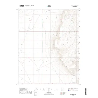
2018 Map of Big Chief Tank
USGS Topo · Published 2018About this map
The Aubrey Cliffs dominate the eastern landscape of this Coconino County terrain, creating a sharp elevation break between the high mesa country and the lower Aubrey Valley to the west. This 2018 survey reveals an arid environment where water management is central to the land's utility, marked by the presence of several named catchment features such as Antelope Tank, Valley Tank, and the eponymous Big Chief Tank. These tanks are critical landmarks for understanding historical ranching and land use in this part of Arizona. To the southeast, the topography becomes increasingly complex as the cliffs give way to deep incisions like Pine Canyon and Rhodes Canyon, illustrating the erosional forces that have shaped this high-desert plateau.
Find a feature on this map
12 named features on this map. Tap any name to fly to it.
Don’t see what you’re looking for? This feature index may not catch every label — zoom into the map to look around manually.
Map Details
Editions of this 2018 Big Chief Tank Map
This is the sole edition of this map. No revisions or reprints were ever made.
Other maps of this area

1886 · Diamond Creek
USGS Topo · 1:250,000

1886 · Chino
USGS Topo · 1:250,000

1891 · Chino
USGS Topo · 1:250,000

1892 · Diamond Creek
USGS Topo · 1:250,000

1948 · Williams
USGS Topo · 1:250,000

1954 · Williams
USGS Topo · 1:250,000

1956 · Williams
USGS Topo · 1:250,000

1960 · Williams
USGS Topo · 1:250,000

1961 · Williams
USGS Topo · 1:250,000
1980 · Robbers Roost Canyon
USGS Topo · 1:24,000