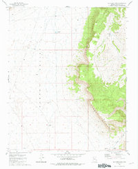
1981 Map of Big Chief Tank
USGS Topo · Published 1981About this map
The Aubrey Cliffs dominate the eastern landscape of this Coconino County terrain, creating a sharp geological divide against the flat expanse of the Aubrey Valley to the west. This 1981 record captures a corner of the Arizona high country where land use is defined by water management in a semi-arid environment. The distribution of small water catchments, such as Big Chief Tank and Antelope Tank, reflects the essential infrastructure for ranching and livestock in this remote basin. Survey markers like the Pica Azimuth Mark No 2 and the South Twin Azimuth Mark are anchored to prominent high points, including South Twin, providing fixed reference points for cartographers and land surveyors. To the southeast, the topography descends into Rhodes Canyon, illustrating the drainage patterns that define the edge of the plateau.
Find a feature on this map
11 named features on this map. Tap any name to fly to it.
Don’t see what you’re looking for? This feature index may not catch every label — zoom into the map to look around manually.
Map Details
Editions of this 1981 Big Chief Tank Map
This is the sole edition of this map. No revisions or reprints were ever made.
Other maps of this area

1886 · Diamond Creek
USGS Topo · 1:250,000

1886 · Chino
USGS Topo · 1:250,000

1891 · Chino
USGS Topo · 1:250,000

1892 · Diamond Creek
USGS Topo · 1:250,000

1948 · Williams
USGS Topo · 1:250,000

1954 · Williams
USGS Topo · 1:250,000

1956 · Williams
USGS Topo · 1:250,000

1960 · Williams
USGS Topo · 1:250,000

1961 · Williams
USGS Topo · 1:250,000
1980 · Robbers Roost Canyon
USGS Topo · 1:24,000