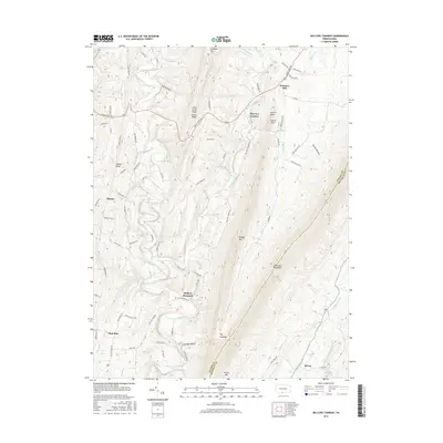
2016 Map of Big Cove Tannery
USGS Topo · Published 2016About this map
Big Cove Creek and its many tributaries carve through the narrow valleys of Fulton County, defining a landscape dominated by the parallel rises of Tuscarora Mountain and Scrub Ridge. This 2016 survey shows the enduring footprint of small crossroads settlements like Websters Mill and the community of Big Cove Tannery, which sits at the base of Dickeys Mountain. The complex topography is marked by named hollows and ridges, including Lockings Hollow and Chestnut Flat, while the eastern border follows the high crest of Tuscarora Mountain into Franklin County. A network of rural routes, such as Great Cove Rd and Big Cove Tannery Rd, connects these isolated valleys, preserving a modern view of a region defined by its rugged Pennsylvania ridge-and-valley geography.
Find a feature on this map
73 named features on this map. Tap any name to fly to it.
Don’t see what you’re looking for? This feature index may not catch every label — zoom into the map to look around manually.
Map Details
Editions of this 2016 Big Cove Tannery Map
This is the sole edition of this map. No revisions or reprints were ever made.
Other maps of this area

1899 · Hancock
USGS Topo · 1:62,500

1900 · Mercersburg
USGS Topo · 1:62,500

1901 · Hancock
USGS Topo · 1:62,500

1902 · Mercersburg
USGS Topo · 1:62,500

1912 · Williamsport
USGS Topo · 1:62,500

1925 · Needmore
USGS Topo · 1:48,000

1935 · Needmore
USGS Topo · 1:62,500

1939 · Needmore
USGS Topo · 1:62,500

1942 · Hagerstown
USGS Topo · 1:125,000

1943 · Hagerstown
USGS Topo · 1:125,000
Featured Places
- Ayr Township, PA
- Warren Township, PA
- Sylvan, Warren Township
- Sharpe, Thompson Township
- Websters Mill, Ayr Township