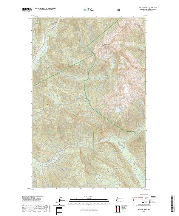
2023 Map of Big Devil Peak
USGS Topo · Published 2023About this map
Big Devil Peak and Little Devil Peak dominate this high-elevation landscape within the North Cascades National Park and the Stephen Mather Wilderness. The terrain is defined by steep glacial drainages including Marble Creek and Copper Creek, which feed into the primary waterways of the Skagit River and the Cascade River. Local access is limited to a handful of forest corridors like Cascade River Rd, while the higher ridges are reached via the Lookout Mt Trl and the Monogram Lake Trl. This area exhibits the complex management boundaries of the modern era, where the Mount Baker National Forest meets protected recreation areas. Notable landmarks like Lookout Mtn and Teebone Ridge rise above alpine basins holding Monogram Lake and La-Rush Lake, illustrating the preserved wilderness character of the Skagit County interior.
Find a feature on this map
57 named features on this map. Tap any name to fly to it.
Don’t see what you’re looking for? This feature index may not catch every label — zoom into the map to look around manually.
Map Details
Editions of this 2023 Big Devil Peak Map
This is the sole edition of this map. No revisions or reprints were ever made.
Other maps of this area

1899 · Glacier Peak
USGS Topo · 1:125,000

1901 · Glacier Peak
USGS Topo · 1:125,000

1953 · Marblemount
USGS Topo · 1:62,500

1955 · Concrete
USGS Topo · 1:250,000

1958 · Concrete
USGS Topo · 1:250,000

1962 · Concrete
USGS Topo · 1:250,000

1963 · Sonny Boy Lakes
USGS Topo · 1:24,000

1963 · Eldorado Peak
USGS Topo · 1:24,000

1963 · Diablo Dam
USGS Topo · 1:24,000
1966 · Snowking Mtn.
USGS Topo · 1:24,000