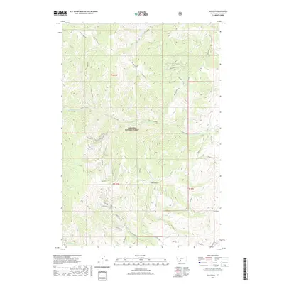
2020 Map of Big Draw
USGS Topo · Published 2020About this map
Gallatin National Forest encompasses the high mountain ridges and deep drainages of this area in Park County. The landscape is defined by its complex network of watercourses and topographical breaks, most notably the central depression of Big Draw and the high-elevation basin of Mud Lake. In the southern reaches of the quadrangle, several branches of Miller Creek and Fridley Cr carve through the terrain, while the northern section is dominated by the N Fork Eightmile and N Dry Divide. The presence of Point Stupid and multiple sections of Pole Gulch suggest a history of local nomenclature tied to the varied and steep geography. Though largely roadless, the far southern edge contains modern access via Gemini Rd and Orion Wy, providing a rare point of entry into the wooded backcountry of the t5s r8e boundary.
Find a feature on this map
48 named features on this map. Tap any name to fly to it.
Don’t see what you’re looking for? This feature index may not catch every label — zoom into the map to look around manually.
Map Details
Editions of this 2020 Big Draw Map
This is the sole edition of this map. No revisions or reprints were ever made.
Other maps of this area

1891 · Livingston
USGS Topo · 1:250,000

1893 · Livingston
USGS Topo · 1:250,000

1947 · Bozeman
USGS Topo · 1:250,000

1948 · Bozeman
USGS Topo · 1:250,000

1951 · Bozeman Pass
USGS Topo · 1:62,500

1951 · Chimney Rock
USGS Topo · 1:24,000

1955 · Bozeman
USGS Topo · 1:250,000

1955 · Emigrant
USGS Topo · 1:62,500

1955 · Fridley Peak
USGS Topo · 1:62,500

1958 · Bozeman
USGS Topo · 1:250,000