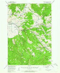
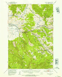
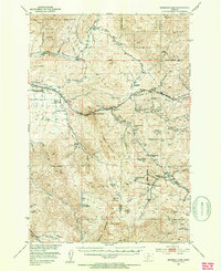
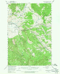
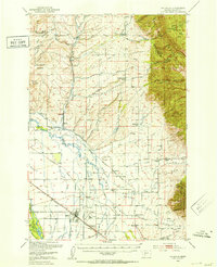
1951 Map of Bozeman Pass
USGS Topo · Published 1952About this map
Bozeman Pass serves as the central focal point of this 1951 topographic survey, where the Northern Pacific railroad and early automotive routes traverse the divide between the Gallatin and Yellowstone drainages. The landscape is defined by its deep industrial roots, particularly concentrated around Chestnut and the surrounding slopes. The map reveals a dense network of coal and mineral extraction sites, including the Anaconda Copper Mines, Stinking Water Mine, and the Coke Ovens (Ruins) near Muir. This era represents a transition where traditional mountain ranching and heavy industry coexist with early recreation, evidenced by the Bozeman Ski Lodge and the Mystic Lake Ranger Station. Genealogy and local history researchers can locate several rural educational landmarks, such as the La Motte School and the Bengtken School (Aban'd), alongside numerous family-named properties like the Mc Reynolds Ranch and Hoffman (Aban'd).
Find a feature on this map
81 named features on this map. Tap any name to fly to it.
Don’t see what you’re looking for? This feature index may not catch every label — zoom into the map to look around manually.
Map Details
Editions of this 1951 Bozeman Pass Map
5 editions found

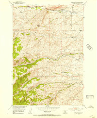
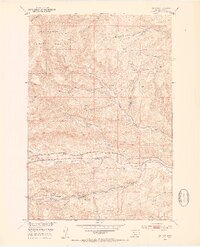
Other maps of this area

1888 · Three Forks
USGS Topo · 1:250,000

1891 · Livingston
USGS Topo · 1:250,000

1893 · Livingston
USGS Topo · 1:250,000

1894 · Three Forks
USGS Topo · 1:250,000

1895 · Three Forks
USGS Topo · 1:250,000

1947 · Bozeman
USGS Topo · 1:250,000

1948 · Bozeman
USGS Topo · 1:250,000
1950 · Belgrade
USGS Topo · 1:62,500
1951 · Gobblers Knob
USGS Topo · 1:24,000
1951 · Hoppers
USGS Topo · 1:24,000