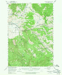
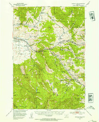
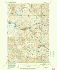
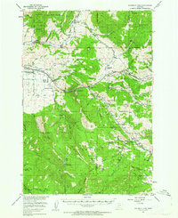
1951 Map of Bozeman Pass
USGS Topo · Published 1971About this map
The Bridger Range and Gallatin Range converge at this vital mountain crossing during the early 1950s, showing a landscape defined by historic transit and extraction. The Northern Pacific railroad winds through the center of the sheet, punctuated by the Bozeman Tunnel and the Bozeman Pass Beacon, marking the path of commerce and travel over the divide. Near the settlement of Chestnut, a concentrated industrial history is visible through numerous workings like the Mountainside Mine and the Coke Ovens (Ruins), indicating the region's former reliance on coal processing. Rural life is anchored by a network of one-room schoolhouses and family holdings, including Malmborg School, La Motte School, and the Thomae Ranch. To the west, the Fort Ellis Historical Marker and the Federal Fish Hatchery sit near the East Gallatin River, where the valley floor begins to open toward the Gallatin basin.
Find a feature on this map
106 named features on this map. Tap any name to fly to it.
Don’t see what you’re looking for? This feature index may not catch every label — zoom into the map to look around manually.
Map Details
Editions of this 1951 Bozeman Pass Map
5 editions found

Other maps of this area

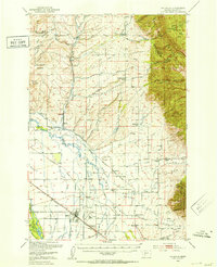
1888 · Three Forks
USGS Topo · 1:250,000

1891 · Livingston
USGS Topo · 1:250,000

1893 · Livingston
USGS Topo · 1:250,000

1894 · Three Forks
USGS Topo · 1:250,000

1895 · Three Forks
USGS Topo · 1:250,000

1947 · Bozeman
USGS Topo · 1:250,000

1948 · Bozeman
USGS Topo · 1:250,000
1950 · Belgrade
USGS Topo · 1:62,500
1951 · Bozeman Pass
USGS Topo · 1:62,500
1951 · Gobblers Knob
USGS Topo · 1:24,000