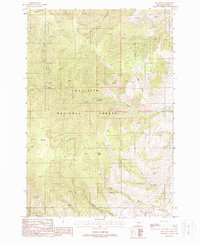
1988 Map of Big Draw
USGS Topo · Published 1988About this map
Gallatin National Forest terrain dominates this 1980s survey, illustrating a landscape defined by sharp elevation changes and high mountain drainage basins. The area is characterized by an intricate network of waterways, including Eightmile Creek, Dry Creek, and Pine Creek, which carve through the high ridges. A distinct sense of the era's backcountry navigation is evident through the numerous Pack Trails that weave across the slopes, providing access to remote landmarks like Point Stupid and the high-altitude Mud Lake.
Find a feature on this map
17 named features on this map. Tap any name to fly to it.
Don’t see what you’re looking for? This feature index may not catch every label — zoom into the map to look around manually.
Map Details
Editions of this 1988 Big Draw Map
This is the sole edition of this map. No revisions or reprints were ever made.
Other maps of this area

1891 · Livingston
USGS Topo · 1:250,000

1893 · Livingston
USGS Topo · 1:250,000

1947 · Bozeman
USGS Topo · 1:250,000

1948 · Bozeman
USGS Topo · 1:250,000

1951 · Bozeman Pass
USGS Topo · 1:62,500

1951 · Chimney Rock
USGS Topo · 1:24,000

1955 · Bozeman
USGS Topo · 1:250,000

1955 · Emigrant
USGS Topo · 1:62,500

1955 · Fridley Peak
USGS Topo · 1:62,500

1958 · Bozeman
USGS Topo · 1:250,000