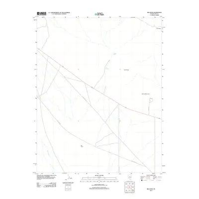
2012 Map of Big Dune
USGS Topo · Published 2012About this map
Big Dune dominates the southern landscape of this Nye County desert expanse, south of the volcanic landmark Lathrop Wells Cone. The terrain is defined by dry drainage systems including Solitario Wash and Crater Flat Wash, which cut through the arid floor toward the Amargosa River at the map's southwestern edge. Human presence is marked by the straight trajectory of US Route 95 and a sparse network of service roads such as Race Track Rd and Valley View Rd. Geological features like Cleft Ridge and Tilted Ridge provide sharp vertical relief in an otherwise expansive desert basin, illustrating the stark topography of the Nevada wasteland at the start of the 2010s.
Find a feature on this map
12 named features on this map. Tap any name to fly to it.
Don’t see what you’re looking for? This feature index may not catch every label — zoom into the map to look around manually.
Map Details
Editions of this 2012 Big Dune Map
This is the sole edition of this map. No revisions or reprints were ever made.
Other maps of this area

1908 · Furnace Creek
USGS Topo · 1:250,000

1910 · Furnace Creek
USGS Topo · 1:250,000

1942 · Skull Mountain
USGS Topo · 1:125,000

1942 · Bullfrog
USGS Topo · 1:125,000

1948 · Death Valley
USGS Topo · 1:250,000

1952 · Topopah Spring
USGS Topo · 1:62,500

1952 · Big Dune
USGS Topo · 1:62,500

1954 · Bare Mtn
USGS Topo · 1:62,500

1954 · Death Valley
USGS Topo · 1:250,000

1956 · Death Valley
USGS Topo · 1:250,000