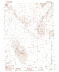
1986 Map of Big Dune
USGS Topo · Published 1986About this map
The Amargosa Desert dominates this arid landscape, characterized by the towering sand deposits of Big Dune in the southwest and the eastern slopes of Yucca Mountain. This 1986 provisional survey captures a sparsely populated stretch of the Nevada desert during a period of geological and infrastructural interest. The small settlement of Ashton sits along the western edge, while an Old Railroad Grade traces a diagonal path across the valley, signaling an era of transport that predated the modern highway. Evidence of resource exploration is scattered throughout the terrain in the form of various prospects and borrow pits. The presence of a long Transmission Line and a specific marked Gate near the southern boundary suggests the region's integration into larger utility and land management networks, even as the landscape remains defined by features like the parched Roses Well.
Find a feature on this map
16 named features on this map. Tap any name to fly to it.
Don’t see what you’re looking for? This feature index may not catch every label — zoom into the map to look around manually.
Map Details
Editions of this 1986 Big Dune Map
This is the sole edition of this map. No revisions or reprints were ever made.
Other maps of this area

1908 · Furnace Creek
USGS Topo · 1:250,000

1910 · Furnace Creek
USGS Topo · 1:250,000

1942 · Skull Mountain
USGS Topo · 1:125,000

1942 · Bullfrog
USGS Topo · 1:125,000

1948 · Death Valley
USGS Topo · 1:250,000

1952 · Topopah Spring
USGS Topo · 1:62,500

1952 · Big Dune
USGS Topo · 1:62,500

1954 · Bare Mtn
USGS Topo · 1:62,500

1954 · Death Valley
USGS Topo · 1:250,000

1956 · Death Valley
USGS Topo · 1:250,000