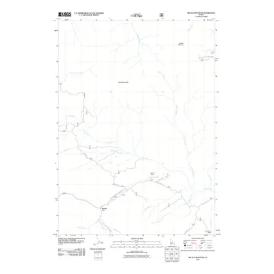
2011 Map of Big Elk Mountain
USGS Topo · Published 2011About this map
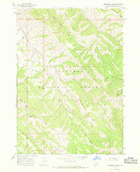
Keenan City sits at the confluence of Keenan Creek and McCoy Creek, serving as a focal point for the drainage systems that define this part of Bonneville County. The landscape is dominated by the massive forms of Big Elk Mountain and Little Elk Mountain, which separate various watersheds including Muddy Creek and Wolverine Creek. The map shows a specialized network of forest infrastructure, such as Natl Forest Develop Road 063 Rd and Brockman Rd, that provides access to the high-elevation Caribou Basin. The presence of Miners Delight Creek and Anderson Gulch suggests a geography shaped by historic resource extraction, with the road network following the winding paths of Camp Creek and other major watercourses through the interior terrain.
Find a feature on this map
28 named features on this map. Tap any name to fly to it.
Don’t see what you’re looking for? This feature index may not catch every label — zoom into the map to look around manually.
Map Details
Editions of this 2011 Big Elk Mountain Map
This is the sole edition of this map. No revisions or reprints were ever made.
Other maps of this area

1932 · Irwin
USGS Topo · 1:96,000

1935 · Irwin
USGS Topo · 1:125,000

1955 · Driggs
USGS Topo · 1:250,000

1958 · Driggs
USGS Topo · 1:250,000

1962 · Driggs
USGS Topo · 1:250,000
1966 · Bear Island
USGS Topo · 1:24,000

1966 · Big Elk Mtn
USGS Topo · 1:24,000
1966 · Tincup Mtn
USGS Topo · 1:24,000
1966 · Herman
USGS Topo · 1:24,000
1966 · Commissary Ridge
USGS Topo · 1:24,000