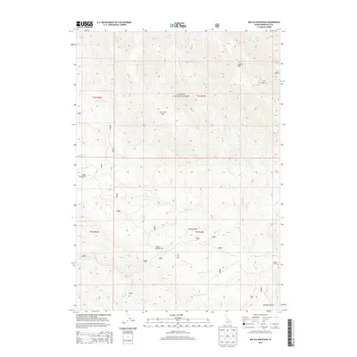
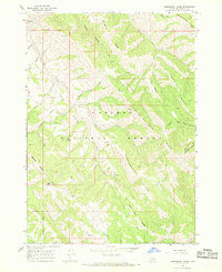
2013 Map of Big Elk Mountain
USGS Topo · Published 2013About this map
Caribou National Forest dominates this section of the Idaho-Wyoming border region, centered on the high peaks and drainages of Big Elk Mtn and Little Elk Mtn. The landscape is defined by its complex network of waterways, including the winding McCoy Cr and the evocative Miners Delight Cr, which hint at the area's legacy of resource extraction and mountain travel. At the heart of the terrain lies Caribou Basin, a natural bowl situated between steep ridges and accessible via Brockman Rd. The map also details the rugged descent into Anderson Gulch and the headwaters of numerous creeks like Wolverine Cr and Keenan Cr. This 2013 survey provides a clear look at the Forest Service road network and the hydrography of the high country, recording the paths and names of a landscape where mining history and wild forest land intersect.
Find a feature on this map
38 named features on this map. Tap any name to fly to it.
Don’t see what you’re looking for? This feature index may not catch every label — zoom into the map to look around manually.
Map Details
Editions of this 2013 Big Elk Mountain Map
This is the sole edition of this map. No revisions or reprints were ever made.
Other maps of this area

1932 · Irwin
USGS Topo · 1:96,000

1935 · Irwin
USGS Topo · 1:125,000

1955 · Driggs
USGS Topo · 1:250,000

1958 · Driggs
USGS Topo · 1:250,000

1962 · Driggs
USGS Topo · 1:250,000
1966 · Bear Island
USGS Topo · 1:24,000

1966 · Big Elk Mtn
USGS Topo · 1:24,000
1966 · Tincup Mtn
USGS Topo · 1:24,000
1966 · Herman
USGS Topo · 1:24,000
1966 · Commissary Ridge
USGS Topo · 1:24,000