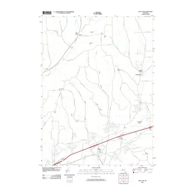
2010 Map of Big Flats
USGS Topo · Published 2010About this map
Big Flats and the surrounding Chemung County countryside are defined by a complex network of valleys and ridges, where agricultural history meets modern transportation infrastructure. The landscape is marked by numerous family and community burial grounds, including Oldfield Cemetery, Miller Cemetery, and Mills Cemetery, which serve as vital landmarks for genealogical research. The valley floor is heavily influenced by water management and transit, featuring the Chemung Feeder Canal and Mud-Ditch alongside the larger Sing Sing Creek.
Find a feature on this map
70 named features on this map. Tap any name to fly to it.
Don’t see what you’re looking for? This feature index may not catch every label — zoom into the map to look around manually.
Map Details
Editions of this 2010 Big Flats Map
This is the sole edition of this map. No revisions or reprints were ever made.
Other maps of this area

1895 · Elmira
USGS Topo · 1:62,500

1898 · Watkins Glen
USGS Topo · 1:62,500

1901 · Watkins
USGS Topo · 1:62,500

1903 · Hammondsport
USGS Topo · 1:62,500

1905 · Watkins Glen
USGS Topo · 1:125,000

1914 · Corning
USGS Topo · 1:62,500

1944 · Corning
USGS Topo · 1:62,500

1950 · Elmira
USGS Topo · 1:250,000

1950 · Montour Falls
USGS Topo · 1:24,000

1953 · Bradford
USGS Topo · 1:24,000