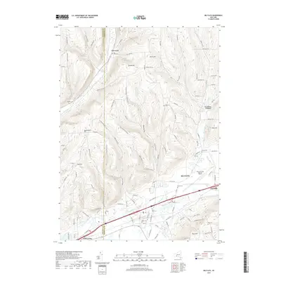
2019 Map of Big Flats
USGS Topo · Published 2019About this map
Big Flats and the surrounding Chemung Valley terrain define this modern survey of the corridor between Elmira and Corning. The landscape is characterized by prominent elevations such as Townley Hill, Quackenbush Hill, and Harris Hill, which overlook a network of hollows and creek beds. A significant piece of regional infrastructure, the Elmira/Corning Regional Airport, occupies a large portion of the flat valley floor, illustrating the area's 21st-century role as a transportation hub.
Find a feature on this map
116 named features on this map. Tap any name to fly to it.
Don’t see what you’re looking for? This feature index may not catch every label — zoom into the map to look around manually.
Map Details
Editions of this 2019 Big Flats Map
This is the sole edition of this map. No revisions or reprints were ever made.
Other maps of this area

1895 · Elmira
USGS Topo · 1:62,500

1898 · Watkins Glen
USGS Topo · 1:62,500

1901 · Watkins
USGS Topo · 1:62,500

1903 · Hammondsport
USGS Topo · 1:62,500

1905 · Watkins Glen
USGS Topo · 1:125,000

1914 · Corning
USGS Topo · 1:62,500

1944 · Corning
USGS Topo · 1:62,500

1950 · Elmira
USGS Topo · 1:250,000

1950 · Montour Falls
USGS Topo · 1:24,000

1953 · Bradford
USGS Topo · 1:24,000