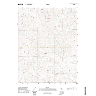
2018 Map of Big Foot Mountain
USGS Topo · Published 2018About this map
Big Foot Mtn and the surrounding coastal range of Northern California dominate this 2018 survey, which straddles the boundary between Mendocino and Sonoma counties. The landscape is defined by its complex drainage network, where Buckeye Cr, Dry Creek, and Wheatfield Fork Gualala River carve deep into the terrain. Several prominent peaks, including Crystal Peak, Mt Tom, and Morris Peak, rise above these watersheds, while named ravines like Redwood Gulch and Franks Canyon suggest the dense timber and secluded geography that characterize this region.
Find a feature on this map
41 named features on this map. Tap any name to fly to it.
Don’t see what you’re looking for? This feature index may not catch every label — zoom into the map to look around manually.
Map Details
Editions of this 2018 Big Foot Mountain Map
This is the sole edition of this map. No revisions or reprints were ever made.
Other maps of this area

1921 · Skaggs
USGS Topo · 1:62,500

1921 · Plantation
USGS Topo · 1:62,500

1938 · Hopland
USGS Topo · 1:62,500

1943 · Tombs Creek
USGS Topo · 1:24,000

1943 · Annapolis
USGS Topo · 1:24,000

1943 · Skaggs Springs
USGS Topo · 1:24,000

1943 · Hopland
USGS Topo · 1:62,500

1943 · Ornbaun
USGS Topo · 1:62,500

1944 · Annapolis
USGS Topo · 1:31,680

1944 · Skaggs Springs
USGS Topo · 1:31,680