
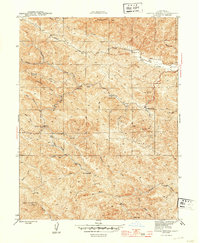
1944 Map of Skaggs Springs
USGS Topo · Published 1944About this map
Skaggs Springs serves as a central landmark in this 1944 survey, situated near the confluence of Warm Springs Creek and Little Warm Springs Creek. The landscape is defined by the complex drainage systems of Dry Creek and its many tributaries, such as Strawberry Creek and Rancheria Creek, which cut through the high terrain of Pritchett Peaks and Bummer Pk. The presence of a Schoolhouse and the Baxter Ranch indicates a dispersed rural community reliant on the local canyon roads and water sources.
Find a feature on this map
31 named features on this map. Tap any name to fly to it.
Don’t see what you’re looking for? This feature index may not catch every label — zoom into the map to look around manually.
Map Details
Editions of this 1944 Skaggs Springs Map
2 editions found
Other maps of this area

1920 · Healdsburg
USGS Topo · 1:62,500

1921 · Skaggs
USGS Topo · 1:62,500

1921 · Kelseyville
USGS Topo · 1:62,500

1933 · Healdsburg
USGS Topo · 1:48,000

1938 · Hopland
USGS Topo · 1:62,500

1940 · Healdsburg
USGS Topo · 1:62,500

1943 · Tombs Creek
USGS Topo · 1:24,000

1943 · Cazadero
USGS Topo · 1:24,000

1943 · Skaggs Springs
USGS Topo · 1:24,000

1943 · Fort Ross
USGS Topo · 1:24,000