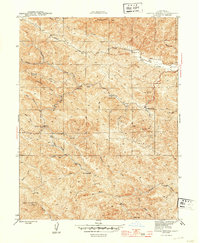
1944 Map of Skaggs Springs
USGS Topo · Published 1944About this map
Skaggs Springs serves as a prominent landmark in this mid-century survey of the Sonoma County interior, situated where several canyon drainages converge. The landscape is defined by a dense network of watercourses, including the winding Dry Creek and Warm Springs Cr, which carve through the high elevations of Pritchett Peaks and Wickersham Ridge. Small-scale settlement and ranching activity are visible at Baxter Ranch and the locality of Walters, connected by the winding Rockpile Road.
Find a feature on this map
34 named features on this map. Tap any name to fly to it.
Don’t see what you’re looking for? This feature index may not catch every label — zoom into the map to look around manually.
Map Details
Editions of this 1944 Skaggs Springs Map
2 editions found

Other maps of this area

1920 · Healdsburg
USGS Topo · 1:62,500

1921 · Skaggs
USGS Topo · 1:62,500

1921 · Kelseyville
USGS Topo · 1:62,500

1933 · Healdsburg
USGS Topo · 1:48,000

1938 · Hopland
USGS Topo · 1:62,500

1940 · Healdsburg
USGS Topo · 1:62,500

1943 · Tombs Creek
USGS Topo · 1:24,000

1943 · Cazadero
USGS Topo · 1:24,000

1943 · Skaggs Springs
USGS Topo · 1:24,000

1943 · Fort Ross
USGS Topo · 1:24,000