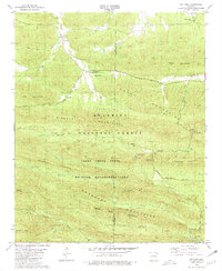
1980 Map of Big Fork
USGS Topo · Published 1981About this map
Big Fork serves as a central hub in this 1980 survey, where the Big Fork stream and Butcherknife Creek converge. The landscape is defined by the high ridges of the Caddo Mountains and Missouri Mountains, much of which is contained within the Ouachita National Forest. This era of the late 1970s shows a region dedicated to conservation and recreation, evidenced by the Caney Creek State Wildlife Management Area and the Little Missouri Falls Recreation Area. Local history is preserved in small family and community landmarks such as Pleasant Grove Cem near Abernathy Spring, and Huddleston Cem in the northeast corner near Sulphur Springs. The drainage patterns of the Little Missouri River and its various forks, including the Dry Fork and Straight Creek, illustrate the complex topography that historically isolated these mountain communities.
Find a feature on this map
46 named features on this map. Tap any name to fly to it.
Don’t see what you’re looking for? This feature index may not catch every label — zoom into the map to look around manually.
Map Details
Editions of this 1980 Big Fork Map
This is the sole edition of this map. No revisions or reprints were ever made.
Other maps of this area

1890 · Mount Ida
USGS Topo · 1:125,000

1890 · Poteau Mountain
USGS Topo · 1:125,000

1899 · Poteau Mountain
USGS Topo · 1:125,000

1906 · Caddo Gap
USGS Topo · 1:125,000

1913 · De Queen
USGS Topo · 1:125,000

1936 · Athens
USGS Topo · 1:48,000

1942 · Athens
USGS Topo · 1:62,500

1950 · Mcalester
USGS Topo · 1:250,000

1955 · Little Rock
USGS Topo · 1:250,000

1956 · Little Rock
USGS Topo · 1:250,000