
1970 Map of Big Gulch
USGS Topo · Published 1973About this map
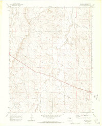
Fondis anchors the southern portion of this Elbert County landscape, where the High Plains drainage system is clearly defined by several significant watercourses. The drainage of West Bijou Creek and its tributary, Spring Branch West Bijou Creek, dominates the central terrain, while Comanche Creek and Big Gulch provide the primary geographic relief. Evidence of local industry and community infrastructure appears through labels for a Claypit and a rural Cem, indicating the small-scale economic and social activity of the area during the late 1960s. Transportation and utility corridors are represented by the transit of Freeze Road and a major Pipeline, showing the modern overlay on a traditional ranching and agricultural region. The map reflects a period of transition as infrastructure began to more prominently crisscross the open drainage basins of eastern Colorado.
Find a feature on this map
13 named features on this map. Tap any name to fly to it.
Don’t see what you’re looking for? This feature index may not catch every label — zoom into the map to look around manually.
Map Details
Editions of this 1970 Big Gulch Map
2 editions found
Other maps of this area

1953 · Denver
USGS Topo · 1:250,000

1957 · Denver
USGS Topo · 1:250,000

1958 · Denver
USGS Topo · 1:250,000

1960 · Denver
USGS Topo · 1:250,000
1970 · Kiowa NE
USGS Topo · 1:24,000
1970 · Fondis
USGS Topo · 1:24,000
1970 · Kiowa NW
USGS Topo · 1:24,000
1970 · Bijou SW
USGS Topo · 1:24,000
1970 · Bijou
USGS Topo · 1:24,000
1970 · Bijou Basin
USGS Topo · 1:24,000