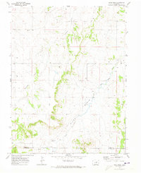
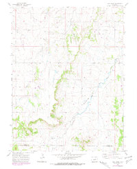
1970 Map of Bijou Basin
USGS Topo · Published 1973About this map
Bijou Basin defines this high plains landscape at the border of Elbert and El Paso counties, characterized by the drainage networks of Comanche Creek and West Bijou Creek. The map documents a rural ranching and resource-extraction environment in the late 1960s, featuring scattered infrastructure such as an Oil Well, a Drill Hole, and a Gravel Pit. For those tracing local history, the Bijou Basin Cem stands as a significant landmark in the southwestern portion of the quadrangle. The topography is marked by distinct rises like the Knob, providing a clear view of how watercourses shaped the early settlement patterns and land use in this part of Colorado. The presence of numerous wells across the terrain underscores the critical importance of water management in this arid cattle-country region.
Find a feature on this map
12 named features on this map. Tap any name to fly to it.
Don’t see what you’re looking for? This feature index may not catch every label — zoom into the map to look around manually.
Map Details
Editions of this 1970 Bijou Basin Map
5 editions found
Other maps of this area

1894 · Castle Rock
USGS Topo · 1:125,000

1913 · Castle Rock
USGS Topo · 1:125,000

1939 · Elizabeth
USGS Topo · 1:62,500

1940 · Elbert
USGS Topo · 1:62,500

1944 · Elbert
USGS Topo · 1:62,500

1945 · Elizabeth
USGS Topo · 1:62,500

1953 · Denver
USGS Topo · 1:250,000
1954 · Eastonville
USGS Topo · 1:24,000

1957 · Denver
USGS Topo · 1:250,000

1958 · Denver
USGS Topo · 1:250,000