
1939 Map of Elizabeth
USGS Topo · Published 1958About this map
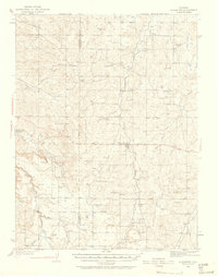
The Site of Gold Discovery by Russell along Russellville Gulch stands as a focal point of this late 1930s survey, marking the early prospecting efforts that shaped the region. Centered on the town of Elizabeth, the landscape reveals a transition from frontier ranching to more settled agricultural communities. A network of rural one-room schoolhouses, including Flintwood Sch, Hilltop Sch, and Gold Dale Sch, anchors the various gulches and flats, while the presence of a CCC Camp near Dry Creek indicates public works activity during the New Deal era.
Find a feature on this map
42 named features on this map. Tap any name to fly to it.
Don’t see what you’re looking for? This feature index may not catch every label — zoom into the map to look around manually.
Map Details
Editions of this 1939 Elizabeth Map
4 editions found
Other maps of this area

1890 · East Denver
USGS Topo · 1:125,000

1894 · Castle Rock
USGS Topo · 1:125,000

1913 · Castle Rock
USGS Topo · 1:125,000

1935 · East Denver Nos. 3 and 4
USGS Topo · 1:48,000

1940 · Piney Creek
USGS Topo · 1:24,000

1940 · Elbert
USGS Topo · 1:62,500

1940 · Castle Rock
USGS Topo · 1:62,500

1942 · Parker
USGS Topo · 1:31,680

1942 · Piney Creek
USGS Topo · 1:31,680

1944 · Elbert
USGS Topo · 1:62,500