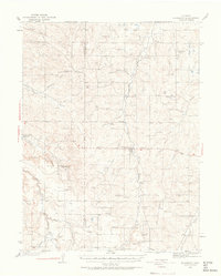
1939 Map of Elizabeth
USGS Topo · Published 1963About this map
Elizabeth and the surrounding high plains of Douglas and Elbert counties are defined here by a network of seasonal drainages and early ranching history. The landscape is marked by the Site of Gold Discovery by Russell along Russellville Gulch, a point of interest for those tracing the 1858 Pikes Peak Gold Rush origins. The region's 1930s social fabric is visible through its numerous rural schoolhouses, including Gold Dale Sch, Flintwood Sch, and Locust Grove Sch. Water remains the central concern of the era, illustrated by named springs and isolated holdings like Idelweiss Ranch and Pine Bar Ranch. The map also captures the presence of a New Deal-era CCC Camp and the quiet solitude of Miller Cem near the confluence of Running Creek and Henderson Gulch.
Find a feature on this map
48 named features on this map. Tap any name to fly to it.
Don’t see what you’re looking for? This feature index may not catch every label — zoom into the map to look around manually.
Map Details
Editions of this 1939 Elizabeth Map
4 editions found
Other maps of this area

1890 · East Denver
USGS Topo · 1:125,000

1894 · Castle Rock
USGS Topo · 1:125,000

1913 · Castle Rock
USGS Topo · 1:125,000

1935 · East Denver Nos. 3 and 4
USGS Topo · 1:48,000

1939 · Elizabeth
USGS Topo · 1:62,500

1940 · Piney Creek
USGS Topo · 1:24,000

1940 · Elbert
USGS Topo · 1:62,500

1940 · Castle Rock
USGS Topo · 1:62,500

1942 · Parker
USGS Topo · 1:31,680

1942 · Piney Creek
USGS Topo · 1:31,680