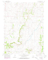
1970 Map of Bijou Basin
USGS Topo · Published 1979About this map
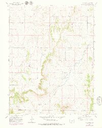
Bijou Basin defines this high-plains landscape where the headwaters of Comanche Creek and West Bijou Creek carve through the terrain of the Colorado plateau. The map captures the area at a point of intersection between Elbert and El Paso counties, showing a rural environment dominated by ranching and resource extraction. Evidence of early industry is scattered across the township lines, including an Oil Well, a Drill Hole, and a Gravel Pit. For those tracing local heritage, the Bijou Basin Cem stands as a primary genealogical landmark situated near the southern reach of the basin. The 1970s photogrammetric revisions, shown in purple, highlight subtle changes in roads and structures, providing a layered view of how this western landscape evolved over a decade of land use.
Find a feature on this map
10 named features on this map. Tap any name to fly to it.
Don’t see what you’re looking for? This feature index may not catch every label — zoom into the map to look around manually.
Map Details
Editions of this 1970 Bijou Basin Map
5 editions found
Other maps of this area

1894 · Castle Rock
USGS Topo · 1:125,000

1913 · Castle Rock
USGS Topo · 1:125,000

1939 · Elizabeth
USGS Topo · 1:62,500

1940 · Elbert
USGS Topo · 1:62,500

1944 · Elbert
USGS Topo · 1:62,500

1945 · Elizabeth
USGS Topo · 1:62,500

1953 · Denver
USGS Topo · 1:250,000
1954 · Eastonville
USGS Topo · 1:24,000

1957 · Denver
USGS Topo · 1:250,000

1958 · Denver
USGS Topo · 1:250,000