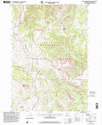
1997 Map of Big Horn Mountain
USGS Topo · Published 2002About this map
Beaverhead National Forest land defines this section of the Madison County high country, where the ridges of the Gravelly Range and Monument Ridge divide numerous alpine drainages. The landscape is marked by seasonal and agricultural infrastructure, such as the Rebish Sheep Headquarters in the southwest and the Black Butte Cabin near the junction of the Gravelly Range Road and Standard Road.
Find a feature on this map
46 named features on this map. Tap any name to fly to it.
Don’t see what you’re looking for? This feature index may not catch every label — zoom into the map to look around manually.
Map Details
Editions of this 1997 Big Horn Mountain Map
This is the sole edition of this map. No revisions or reprints were ever made.
Other maps of this area

1888 · Three Forks
USGS Topo · 1:250,000

1894 · Three Forks
USGS Topo · 1:250,000

1895 · Three Forks
USGS Topo · 1:250,000

1947 · Bozeman
USGS Topo · 1:250,000

1948 · Bozeman
USGS Topo · 1:250,000

1949 · Varney
USGS Topo · 1:62,500

1950 · Cliff Lake
USGS Topo · 1:62,500

1950 · Cameron
USGS Topo · 1:62,500

1950 · Monument Ridge
USGS Topo · 1:62,500

1955 · Bozeman
USGS Topo · 1:250,000