
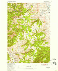
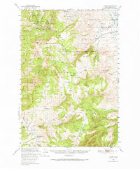
1949 Map of Varney
USGS Topo · Published 1952About this map
Mining operations dominate the northern slopes of the Gravelly Range in this late 1940s landscape, where legacy extraction sites like the Pacific Mine, General Shafter Mine, and Kearsarge Mine cluster around Alder Gulch. The terrain transitions from these industrial highlands into the Beaverhead National Forest, where conservation and land management infrastructure is evident at the Crockett Lake Ranger Station and the Vigilante Exp Range Headquarters.
Find a feature on this map
88 named features on this map. Tap any name to fly to it.
Don’t see what you’re looking for? This feature index may not catch every label — zoom into the map to look around manually.
Map Details
Editions of this 1949 Varney Map
3 editions found
Other maps of this area

1888 · Three Forks
USGS Topo · 1:250,000

1893 · Dillon
USGS Topo · 1:250,000

1894 · Three Forks
USGS Topo · 1:250,000

1895 · Three Forks
USGS Topo · 1:250,000

1947 · Bozeman
USGS Topo · 1:250,000

1948 · Bozeman
USGS Topo · 1:250,000

1949 · Ennis
USGS Topo · 1:62,500

1950 · Cliff Lake
USGS Topo · 1:62,500

1950 · Cameron
USGS Topo · 1:62,500

1950 · Virginia City
USGS Topo · 1:62,500