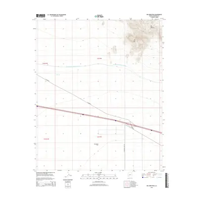
2014 Map of Big Horn Peak
USGS Topo · Published 2014About this map
Big Horn Peak rises prominently above the desert landscape in this portion of Maricopa County, marking the southern extent of the Big Horn Mountains. The terrain transitions sharply from these high elevations down to the expansive Harquahala Plain, a broad alluvial expanse that dominates the southern half of the map. This 2014 survey documents the critical water infrastructure of the American Southwest, specifically the Central Arizona Project Aqueduct as it cuts a steady course across the desert floor. Transportation through this arid region is defined by the diagonal path of W Salome Rd and the straight line of N Harquahala Valley Rd, which intersect near the crossing of Interstate 10. Minor features like New Tank indicate the vital role of water management for local land use and ranching in this high-heat environment.
Find a feature on this map
12 named features on this map. Tap any name to fly to it.
Don’t see what you’re looking for? This feature index may not catch every label — zoom into the map to look around manually.
Map Details
Editions of this 2014 Big Horn Peak Map
This is the sole edition of this map. No revisions or reprints were ever made.
Other maps of this area

1942 · Vicksburg
USGS Topo · 1:250,000

1954 · Phoenix
USGS Topo · 1:250,000

1957 · Phoenix
USGS Topo · 1:250,000

1958 · Phoenix
USGS Topo · 1:250,000

1960 · Phoenix
USGS Topo · 1:250,000

1961 · Lone Mountain
USGS Topo · 1:62,500

1961 · Big Horn Mts
USGS Topo · 1:62,500

1962 · Cortez Peak
USGS Topo · 1:62,500

1962 · Eagletail Mts
USGS Topo · 1:62,500

1969 · Phoenix
USGS Topo · 1:250,000