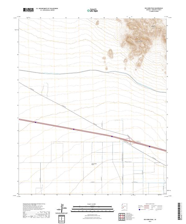
2021 Map of Big Horn Peak
USGS Topo · Published 2021About this map
Big Horn Peak rises as the dominant landmark within the Big Horn Mountains in this modern topographical survey of Maricopa County. The landscape is defined by the sharp contrast between these high peaks and the broad expanse of the Harquahala Plain to the south. Cutting across this desert terrain is the Central Arizona Project Aqueduct, a massive engineering feat that recontoured the area to support regional water needs. Below the mountains, the valley floor is strictly partitioned by the Public Land Survey System, as seen in the grid of section lines and range markers such as t3n r9w. A network of thoroughfares including Salome Rd and W Harquahala Valley Rd connects the open sections, following the established section boundaries that define the agricultural and residential potential of the plain.
Find a feature on this map
20 named features on this map. Tap any name to fly to it.
Don’t see what you’re looking for? This feature index may not catch every label — zoom into the map to look around manually.
Map Details
Editions of this 2021 Big Horn Peak Map
This is the sole edition of this map. No revisions or reprints were ever made.
Other maps of this area

1942 · Vicksburg
USGS Topo · 1:250,000

1954 · Phoenix
USGS Topo · 1:250,000

1957 · Phoenix
USGS Topo · 1:250,000

1958 · Phoenix
USGS Topo · 1:250,000

1960 · Phoenix
USGS Topo · 1:250,000

1961 · Lone Mountain
USGS Topo · 1:62,500

1961 · Big Horn Mts
USGS Topo · 1:62,500

1962 · Cortez Peak
USGS Topo · 1:62,500

1962 · Eagletail Mts
USGS Topo · 1:62,500

1969 · Phoenix
USGS Topo · 1:250,000