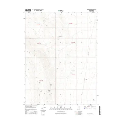
2014 Map of Big Horseshoe
USGS Topo · Published 2014About this map
Disappointment Hills and the Confusion Range dominate this corner of Millard County, where the desert landscape is defined by its dramatic geologic folds and sparse water sources. The map reveals a topography shaped by erosion and isolation, featuring prominent landmarks like Big Horseshoe and its smaller counterpart, Little Horseshoe. Transportation across this arid basin is limited to utilitarian routes such as Well 58 Rd and Coyote Springs Rd, which skirt the edges of the high ground to reach the expansive Tule Valley. Notable for local history and physical geography is the Confusion Hills Reservoir, a critical water point in a region otherwise characterized by its dry ridges, including Chevron Ridge and Plympton Ridge. The presence of Indian Pass suggests a natural transit corridor through the uplifted terrain, providing a look at the historical movement patterns within the eastern Great Basin.
Find a feature on this map
15 named features on this map. Tap any name to fly to it.
Don’t see what you’re looking for? This feature index may not catch every label — zoom into the map to look around manually.
Map Details
Editions of this 2014 Big Horseshoe Map
This is the sole edition of this map. No revisions or reprints were ever made.
Other maps of this area

1908 · Fish Springs
USGS Topo · 1:250,000

1910 · Fish Springs
USGS Topo · 1:250,000

1953 · Delta
USGS Topo · 1:250,000

1958 · Delta
USGS Topo · 1:250,000

1959 · Cowboy Pass
USGS Topo · 1:62,500

1960 · Granite Mountain
USGS Topo · 1:62,500

1960 · Gandy
USGS Topo · 1:62,500

1961 · Trout Creek
USGS Topo · 1:62,500

1962 · Delta
USGS Topo · 1:250,000
1979 · Fish Springs
USGS Topo · 1:100,000