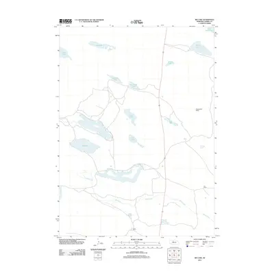
2011 Map of Big Lake
USGS Topo · Published 2011About this map
Goose Creek winds through this section of the Nebraska Sandhills, a landscape defined by an intricate network of shallow lakes and isolated ranching outposts. This 2011 survey captures the enduring character of Cherry County's cattle country, where family-named operations like Vian Ranch and the J Lee Ranch manage vast stretches of grazing land. The geography is dominated by a series of basins including Big Lake, Lost Lake, and Pony Lake, many of which sit at the base of subtle rises or within the Sweetwater Valley.
Find a feature on this map
15 named features on this map. Tap any name to fly to it.
Don’t see what you’re looking for? This feature index may not catch every label — zoom into the map to look around manually.
Map Details
Editions of this 2011 Big Lake Map
This is the sole edition of this map. No revisions or reprints were ever made.
Other maps of this area

1949 · Long Lake
USGS Topo · 1:62,500

1950 · Simeon
USGS Topo · 1:62,500

1950 · Arabia
USGS Topo · 1:62,500

1951 · Long Lake
USGS Topo · 1:62,500

1951 · Brownlee
USGS Topo · 1:62,500

1957 · Valentine
USGS Topo · 1:250,000

1959 · Valentine
USGS Topo · 1:250,000

1985 · Long Lake
USGS Topo · 1:24,000
1985 · Arabia SW
USGS Topo · 1:24,000

1985 · Goose Creek
USGS Topo · 1:100,000