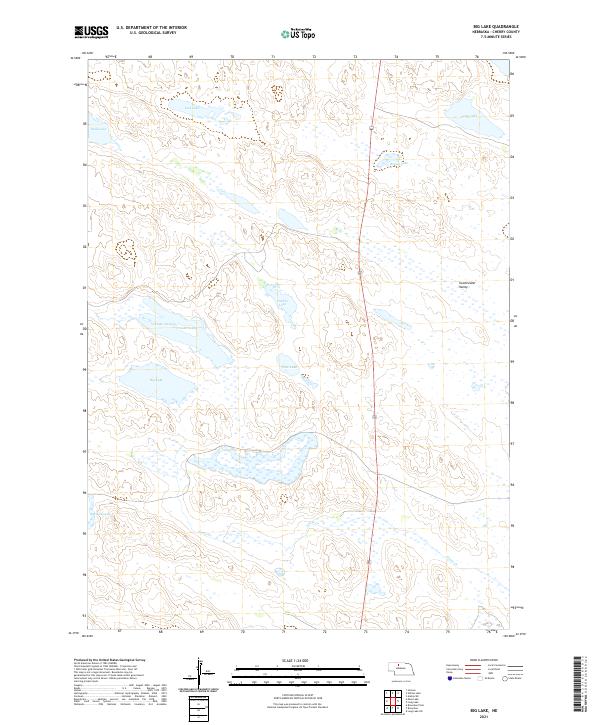
2021 Map of Big Lake
USGS Topo · Published 2021About this map
Sweetwater Valley serves as a prominent geographic landmark in this portion of the Nebraska Sandhills, where the landscape is defined by an intricate network of wetlands and shallow basins. This modern survey illustrates a topography dominated by the seasonal and permanent hydrology of Goose Cr and the numerous depressions that form locally significant water bodies. These features, ranging from the namesake Big Lake to smaller basins like Durbin Lake and Tate Lake, indicate a delicate environmental balance where the water table meets the surface of the dunes.
Find a feature on this map
16 named features on this map. Tap any name to fly to it.
Don’t see what you’re looking for? This feature index may not catch every label — zoom into the map to look around manually.
Map Details
Editions of this 2021 Big Lake Map
This is the sole edition of this map. No revisions or reprints were ever made.
Other maps of this area

1949 · Long Lake
USGS Topo · 1:62,500

1950 · Simeon
USGS Topo · 1:62,500

1950 · Arabia
USGS Topo · 1:62,500

1951 · Long Lake
USGS Topo · 1:62,500

1951 · Brownlee
USGS Topo · 1:62,500

1957 · Valentine
USGS Topo · 1:250,000

1959 · Valentine
USGS Topo · 1:250,000

1985 · Long Lake
USGS Topo · 1:24,000
1985 · Arabia SW
USGS Topo · 1:24,000

1985 · Goose Creek
USGS Topo · 1:100,000