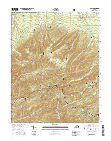
2016 Map of Big Levels
USGS Topo · Published 2016About this map
Stuarts Draft and the small settlement of Love anchor this 2016 survey of the Blue Ridge mountain front. The landscape is dominated by the sprawling George Washington National Forest, where high elevations like Donald Fauber Mtn and Bald Mtn separate the Shenandoah Valley from the eastern slopes. The Blue Ridge Parkway winds along the crest, passing notable landmarks such as Copelands Rocks and White Rock Gap.
Find a feature on this map
67 named features on this map. Tap any name to fly to it.
Don’t see what you’re looking for? This feature index may not catch every label — zoom into the map to look around manually.
Map Details
Editions of this 2016 Big Levels Map
This is the sole edition of this map. No revisions or reprints were ever made.
Other maps of this area

1892 · Buckingham
USGS Topo · 1:125,000

1892 · Harrisonburg
USGS Topo · 1:125,000

1894 · Staunton
USGS Topo · 1:125,000

1894 · Lexington
USGS Topo · 1:125,000

1934 · Waynesboro
USGS Topo · 1:48,000

1936 · Vesuvius
USGS Topo · 1:48,000

1939 · Waynesboro
USGS Topo · 1:62,500

1941 · Vesuvius
USGS Topo · 1:62,500

1943 · Lovingston
USGS Topo · 1:62,500

1944 · Staunton
USGS Topo · 1:62,500