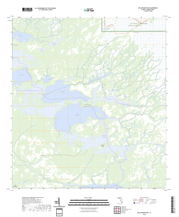
2024 Map of Big Lostmans Bay
USGS Topo · Published 2024About this map
Marjory Stoneman Douglas Wilderness forms the core of this aquatic landscape within Everglades National Park, where the boundary of Big Cypress National Preserve meets the northern reaches of the marsh. The geography is defined by a intricate system of bays and rivers, including Big Lostmans Bay, Rodgers River Bay, and Broad River Bay, connected by tidal flows such as The Cutoff and Rodgers Creek.
Find a feature on this map
31 named features on this map. Tap any name to fly to it.
Don’t see what you’re looking for? This feature index may not catch every label — zoom into the map to look around manually.
Map Details
Editions of this 2024 Big Lostmans Bay Map
This is the sole edition of this map. No revisions or reprints were ever made.
Other maps of this area

1956 · Miami
USGS Topo · 1:250,000

1958 · Miami
USGS Topo · 1:250,000

1972 · Harney River
USGS Topo · 1:24,000

1972 · Lostmans Trail
USGS Topo · 1:24,000

1972 · Big Boy Lake
USGS Topo · 1:24,000

1972 · Tarpon Bay
USGS Topo · 1:24,000

1972 · Indian Camp Creek
USGS Topo · 1:24,000

1972 · Shark Point
USGS Topo · 1:24,000

1973 · Big Lostmans Bay
USGS Topo · 1:24,000

1973 · Lostmans River Ranger Station
USGS Topo · 1:24,000