
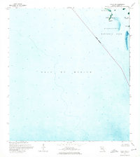
1973 Map of Lostmans River Ranger Station
USGS Topo · Published 1976About this map
Everglades National Park's coastal mangrove wilderness is meticulously documented in this orthophotomap, which combines photographic aerial imagery with traditional topographic data. The map reveals a complex web of tidal creeks and brackish bays where the Lostmans River meets the Gulf of Mexico. Beyond the natural hydrology of First Bay and Second Bay, the map identifies rare human footprints in this remote environment, including the Lostmans River Ranger Station and isolated settlements like Walter Hamilton Place and Leon Hamilton Place. Cultural landmarks such as Hamilton Mound and Johnsons Mound indicate long-standing human presence on elevated ground amidst the swamps. Navigational features, including the Onion Key Campsite and a Radio Tower, highlight the area's role as a monitored frontier of the Florida coast in the early 1970s.
Find a feature on this map
39 named features on this map. Tap any name to fly to it.
Don’t see what you’re looking for? This feature index may not catch every label — zoom into the map to look around manually.
Map Details
Editions of this 1973 Lostmans River Ranger Station Map
This is the sole edition of this map. No revisions or reprints were ever made.
Other maps of this area

1956 · Miami
USGS Topo · 1:250,000

1958 · Miami
USGS Topo · 1:250,000

1972 · Harney River
USGS Topo · 1:24,000

1972 · Big Boy Lake
USGS Topo · 1:24,000

1972 · Shark Point
USGS Topo · 1:24,000

1973 · Pavilion Key
USGS Topo · 1:24,000
1973 · Plover Key
USGS Topo · 1:24,000

1973 · Big Lostmans Bay
USGS Topo · 1:24,000

1973 · Alligator Bay
USGS Topo · 1:24,000

1981 · Cape Sable
USGS Topo · 1:100,000