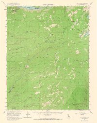
1956 Map of Big Meadow
USGS Topo · Published 1967About this map
The high Sierra landscape of the Stanislaus National Forest and Eldorado National Forest dominates this mid-century survey. While the terrain is characterized by deep river canyons like those carved by the North Fork Mokelumne River and the Stanislaus River, the map records a human imprint tied to seasonal grazing, travel, and early recreation. Evidence of historic transit remains at the Bloods Toll Sta (Site) near Bear Valley, while numerous family-named landmarks such as Mattley Cabin, Brown Boy Cabin, and Airola suggest a legacy of high-country homesteading and resource management. The emergence of the region as a recreational destination is visible through features like the Boy Scout Camp and the Big Meadow Campground, existing alongside infrastructure such as the Highway Maintenance Sta at the Cabbage Patch.
Find a feature on this map
105 named features on this map. Tap any name to fly to it.
Don’t see what you’re looking for? This feature index may not catch every label — zoom into the map to look around manually.
Map Details
Editions of this 1956 Big Meadow Map
4 editions found
Other maps of this area

1889 · Pyramid Peak
USGS Topo · 1:125,000

1889 · Markleeville
USGS Topo · 1:125,000

1891 · Markleeville
USGS Topo · 1:125,000

1891 · Big Trees
USGS Topo · 1:125,000

1891 · Pyramid Peak
USGS Topo · 1:125,000

1893 · Markleeville
USGS Topo · 1:125,000

1894 · Big Trees
USGS Topo · 1:125,000

1895 · Pyramid Peak
USGS Topo · 1:125,000

1896 · Dardanelles
USGS Topo · 1:125,000

1896 · Pyramid Peak
USGS Topo · 1:125,000