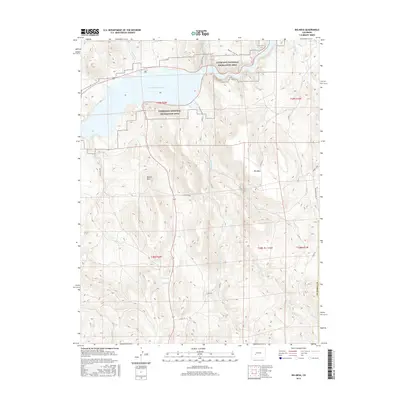
2016 Map of Big Mesa
USGS Topo · Published 2016About this map
The Blue Mesa Reservoir dominates the northern landscape of this Gunnison County region, where the high-altitude waters are fed by a network of drainage systems including Steuben Creek, Willow Cr, and Stevens Cr. To the south, the expansive high-desert terrain of Big Mesa rises as a prominent landform, its slopes marked by rugged outcroppings like Blaine Rock. This 2016 survey illustrates the extensive road and trail network that provides access to the Curecanti National Recreation Area, from established routes like Vulcan Road to the primitive Beaver Creek Trail. The map documents a sparsely populated but vital corridor of public lands, capturing the intersections of water management, recreation, and the persistent grazing and ranching geography of the Colorado interior, evidenced by features such as Big Springs and various cattle-related drainage names like Corral Cr.
Find a feature on this map
31 named features on this map. Tap any name to fly to it.
Don’t see what you’re looking for? This feature index may not catch every label — zoom into the map to look around manually.
Map Details
Editions of this 2016 Big Mesa Map
This is the sole edition of this map. No revisions or reprints were ever made.
Other maps of this area

1908 · Uncompahgre
USGS Topo · 1:125,000

1911 · Uncompahgre
USGS Topo · 1:125,000

1954 · Iris NW
USGS Topo · 1:24,000

1954 · Iola
USGS Topo · 1:24,000

1954 · Mc Intosh Mountain
USGS Topo · 1:24,000

1954 · West Elk Peak SW
USGS Topo · 1:24,000

1954 · Gunnison
USGS Topo · 1:24,000

1954 · Cebolla
USGS Topo · 1:24,000

1954 · Gateview
USGS Topo · 1:24,000

1956 · Montrose
USGS Topo · 1:250,000