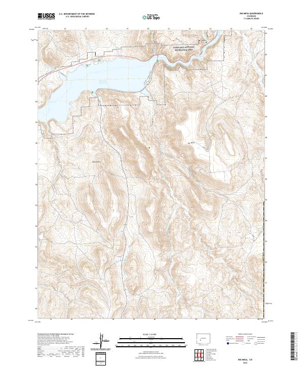
2022 Map of Big Mesa
USGS Topo · Published 2022About this map
Blue Mesa Reservoir dominates the northern landscape of this Gunnison County quadrangle, where the impounded waters of the Gunnison River meet the steep slopes of the West Elk Mountains. This 2022 survey illustrates the modern layout of the Curecanti National Recreation Area, showing the infrastructure of the CO HWY 149 Beach Access and several trail systems like the Beaver Creek Trl. Rising south of the water, the massive flat-topped Big Mesa and the prominent Blaine Rock define the local topography.
Find a feature on this map
32 named features on this map. Tap any name to fly to it.
Don’t see what you’re looking for? This feature index may not catch every label — zoom into the map to look around manually.
Map Details
Editions of this 2022 Big Mesa Map
This is the sole edition of this map. No revisions or reprints were ever made.
Other maps of this area

1908 · Uncompahgre
USGS Topo · 1:125,000

1911 · Uncompahgre
USGS Topo · 1:125,000

1954 · Iris NW
USGS Topo · 1:24,000

1954 · Iola
USGS Topo · 1:24,000

1954 · Mc Intosh Mountain
USGS Topo · 1:24,000

1954 · West Elk Peak SW
USGS Topo · 1:24,000

1954 · Gunnison
USGS Topo · 1:24,000

1954 · Cebolla
USGS Topo · 1:24,000

1954 · Gateview
USGS Topo · 1:24,000

1956 · Montrose
USGS Topo · 1:250,000