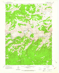
1962 Map of Big Narrows
USGS Topo · Published 1964About this map
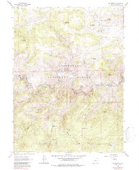
Roosevelt National Forest defines the steep terrain of this Larimer County landscape, where the Cache La Poudre River carves a deep canyon through the Big Narrows. The 1962 survey illustrates a rugged era of mountain habitation, preserved in family-named landmarks like the Bosworth Homestead and Clark Homestead. Settlement patterns follow the river and the flatter canyon benches, including Eggers, Kelley Flats, and Dutch George Flats. Higher elevations are marked by granite peaks such as Manhead Mountain and Mount McConnel, while recreational infrastructure is visible at the Fort Collins Mountain Recreation Area and Stove Prairie Landing. This map captures a transition between traditional ranching, evidenced by the Lewis Ranch and Sky Corral Ranch, and the emerging role of the forest as a public recreational resource.
Find a feature on this map
40 named features on this map. Tap any name to fly to it.
Don’t see what you’re looking for? This feature index may not catch every label — zoom into the map to look around manually.
Map Details
Editions of this 1962 Big Narrows Map
6 editions found
Other maps of this area

1907 · Livermore
USGS Topo · 1:125,000

1909 · Livermore
USGS Topo · 1:125,000

1916 · Home
USGS Topo · 1:125,000

1920 · Home
USGS Topo · 1:125,000

1954 · Greeley
USGS Topo · 1:250,000

1957 · Greeley
USGS Topo · 1:250,000

1958 · Greeley
USGS Topo · 1:250,000

1960 · Haystack Gulch
USGS Topo · 1:24,000

1960 · Livermore Mountain
USGS Topo · 1:24,000

1961 · Greeley
USGS Topo · 1:250,000