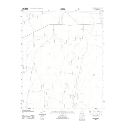
2011 Map of Big Pug Tank
USGS Topo · Published 2011About this map
Cottonwood Wash and Day Wash dominate this arid Navajo County landscape, where water management is the primary marker of human activity and land use. The map reveals a sophisticated network of earthen reservoirs and catchments, often named for local geographic features or nearby vegetation, such as Swale Tank, Clay Springs Tank, and Holy Oak Tank. The eponymous Big Pug Tank and its neighbor Little Pug Tank sit near the center of the quadrangle, serving as vital water sources in an environment otherwise defined by ephemeral drainages.
Find a feature on this map
30 named features on this map. Tap any name to fly to it.
Don’t see what you’re looking for? This feature index may not catch every label — zoom into the map to look around manually.
Map Details
Editions of this 2011 Big Pug Tank Map
This is the sole edition of this map. No revisions or reprints were ever made.
Other maps of this area

1886 · Holbrook
USGS Topo · 1:250,000

1893 · Holbrook
USGS Topo · 1:250,000

1954 · Holbrook
USGS Topo · 1:250,000

1957 · Holbrook
USGS Topo · 1:250,000

1958 · Holbrook
USGS Topo · 1:250,000

1960 · Holbrook
USGS Topo · 1:250,000

1961 · Clay Springs
USGS Topo · 1:62,500
1970 · Cactus Flat
USGS Topo · 1:24,000
1970 · Second Knolls
USGS Topo · 1:24,000
1970 · Pinedale
USGS Topo · 1:24,000