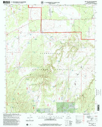
1998 Map of Big Pug Tank
USGS Topo · Published 2000About this map
Sitgreaves National Forest dominates this section of the Colorado Plateau, where the landscape is defined by an intricate system of water management features and cattle tanks. The map captures a moment in the late 1990s when the region's ranching and forestry heritage was deeply etched into the terrain, most notably at the northern edge where Snowflake Landing and Decker mark localized activity near the Third Standard Parallel North.
Find a feature on this map
55 named features on this map. Tap any name to fly to it.
Don’t see what you’re looking for? This feature index may not catch every label — zoom into the map to look around manually.
Map Details
Editions of this 1998 Big Pug Tank Map
This is the sole edition of this map. No revisions or reprints were ever made.
Other maps of this area

1886 · Holbrook
USGS Topo · 1:250,000

1893 · Holbrook
USGS Topo · 1:250,000

1954 · Holbrook
USGS Topo · 1:250,000

1957 · Holbrook
USGS Topo · 1:250,000

1958 · Holbrook
USGS Topo · 1:250,000

1960 · Holbrook
USGS Topo · 1:250,000

1961 · Clay Springs
USGS Topo · 1:62,500
1970 · Cactus Flat
USGS Topo · 1:24,000
1970 · Second Knolls
USGS Topo · 1:24,000
1970 · Pinedale
USGS Topo · 1:24,000