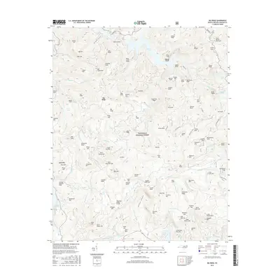
2016 Map of Big Ridge
USGS Topo · Published 2016About this map
Lake Glenville and the Nantahala National Forest dominate this section of the Blue Ridge, where steep slopes fall toward the high-altitude waters of Bear Creek Lake and Cedar Cliff Lake. The settlement of Glenville serves as a focal point near the western edge, while the scattered community of Big Ridge occupies the central heights. The landscape is defined by its dramatic relief, including the Great Balsam Mountains and distinctive landmarks like Island Ford and the treacherous-sounding Bonas Defeat. Numerous named falls and coves, such as Schoolhouse Falls and Shook Cove, suggest a geography where water and terrain shaped the early access and settlement patterns of Jackson County. This survey traces the modern road network, including Canada Rd, against a backdrop of traditional family-named ridges and gaps like Lizzie Mtn and Bull Gap.
Find a feature on this map
162 named features on this map. Tap any name to fly to it.
Don’t see what you’re looking for? This feature index may not catch every label — zoom into the map to look around manually.
Map Details
Editions of this 2016 Big Ridge Map
This is the sole edition of this map. No revisions or reprints were ever made.
Other maps of this area

1891 · Cowee
USGS Topo · 1:125,000

1897 · Cowee
USGS Topo · 1:125,000

1905 · Pisgah
USGS Topo · 1:125,000

1906 · Pisgah
USGS Topo · 1:125,000

1907 · Cowee
USGS Topo · 1:125,000

1935 · Sam Knob
USGS Topo · 1:24,000

1935 · Cashiers
USGS Topo · 1:24,000

1935 · Tuckaseigee
USGS Topo · 1:24,000

1935 · Lake Toxaway
USGS Topo · 1:24,000

1935 · Reid
USGS Topo · 1:24,000