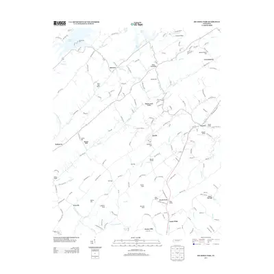
2013 Map of Big Ridge Park
USGS Topo · Published 2013About this map
Norris Lake dominates the northern reaches of this East Tennessee landscape, its fingers reaching into deep valleys created by the ridgelines of Chestnut Ridge and Copper Ridge. The map details a transition from the submerged shoreline near Andersonville Dock to the established agricultural and residential pockets of the Hinds Creek Valley. Numerous named gaps, such as Malone Gap and Collins Gap, reveal the historic transportation routes used to navigate this corrugated terrain before modern road improvements. The settlement pattern is defined by small, decentralized communities like New Loyston, Paulette, and Warwicktown, often situated at key road junctions or near water sources. Significant landmarks for local history include the site of Stokes Mill on Hinds Creek and several topographic features named for early families, such as Longmire Bluff and Bayless Gap.
Find a feature on this map
171 named features on this map. Tap any name to fly to it.
Don’t see what you’re looking for? This feature index may not catch every label — zoom into the map to look around manually.
Map Details
Editions of this 2013 Big Ridge Park Map
This is the sole edition of this map. No revisions or reprints were ever made.
Other maps of this area

1893 · Briceville
USGS Topo · 1:125,000

1895 · Briceville
USGS Topo · 1:125,000

1896 · Briceville
USGS Topo · 1:125,000

1897 · Maynardville
USGS Topo · 1:125,000

1900 · Maynardville
USGS Topo · 1:125,000

1935 · Graveston
USGS Topo · 1:24,000

1935 · Fountain City
USGS Topo · 1:24,000

1936 · Gorryton
USGS Topo · 1:48,000

1936 · White Hollow
USGS Topo · 1:24,000
1936 · John Sevier
USGS Topo · 1:24,000