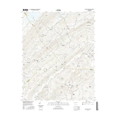
2016 Map of Big Ridge Park
USGS Topo · Published 2016About this map
Norris Lake defines the northern reaches of this East Tennessee landscape, where the waters of Buffalo Cr and Hinds Cr flow through a series of prominent ridges and valleys. The area is characterized by long, parallel elevations like Copper Ridge, Chestnut Ridge, and Bullrun Ridge, which separate agricultural corridors such as Raccoon Valley and Hinds Creek Valley. This topography dictated the placement of small communities including New Loyston, Paulette, and Melbourne. For genealogists, the map is remarkably dense with family burial grounds, such as Ridenour Cem, Hansard Cem, and Snodderly Cem. A historical focal point is Stokes Mill, situated near Collins Gap, marking a site of early local industry. The map also captures several gaps that served as essential transit points through the steep terrain, including McHaffie Gap and Bayless Gap.
Find a feature on this map
177 named features on this map. Tap any name to fly to it.
Don’t see what you’re looking for? This feature index may not catch every label — zoom into the map to look around manually.
Map Details
Editions of this 2016 Big Ridge Park Map
This is the sole edition of this map. No revisions or reprints were ever made.
Other maps of this area

1893 · Briceville
USGS Topo · 1:125,000

1895 · Briceville
USGS Topo · 1:125,000

1896 · Briceville
USGS Topo · 1:125,000

1897 · Maynardville
USGS Topo · 1:125,000

1900 · Maynardville
USGS Topo · 1:125,000

1935 · Graveston
USGS Topo · 1:24,000

1935 · Fountain City
USGS Topo · 1:24,000

1936 · Gorryton
USGS Topo · 1:48,000

1936 · White Hollow
USGS Topo · 1:24,000
1936 · John Sevier
USGS Topo · 1:24,000