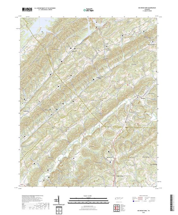
2022 Map of Big Ridge Park
USGS Topo · Published 2022About this map
Norris Lake dominates the northern landscape of this region, where the flooded valleys of Buffalo Creek and Mill Creek Run reach into the ridge-and-valley terrain. The map documents a dense network of family history markers, particularly numerous cemeteries such as Snodderly Cemetery, Hutcheson Cemetery, and Vandagriff Cemetery that dot the high ground. The settlement pattern follows the narrow valleys, with New Loyston and Ridenour established near the lake's edge, while Stokes Mill and Melbourne occupy the interior gaps.
Find a feature on this map
162 named features on this map. Tap any name to fly to it.
Don’t see what you’re looking for? This feature index may not catch every label — zoom into the map to look around manually.
Map Details
Editions of this 2022 Big Ridge Park Map
This is the sole edition of this map. No revisions or reprints were ever made.
Other maps of this area

1893 · Briceville
USGS Topo · 1:125,000

1895 · Briceville
USGS Topo · 1:125,000

1896 · Briceville
USGS Topo · 1:125,000

1897 · Maynardville
USGS Topo · 1:125,000

1900 · Maynardville
USGS Topo · 1:125,000

1935 · Graveston
USGS Topo · 1:24,000

1935 · Fountain City
USGS Topo · 1:24,000

1936 · Gorryton
USGS Topo · 1:48,000

1936 · White Hollow
USGS Topo · 1:24,000
1936 · John Sevier
USGS Topo · 1:24,000