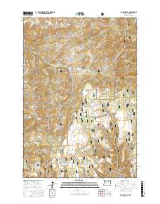
2017 Map of Big Rock Flat
USGS Topo · Published 2017About this map
Umatilla National Forest dominates this section of the Blue Mountains, where the landscape is defined by a dense network of forest development roads and specialized water features. The terrain transitions from high buttes like Barlow Butte and Opal Butte to broad upland plateaus, including Big Rock Flat and Snowshoe Flat. This 2017 survey shows how the land is managed for both preservation and utility, evidenced by the Rough Canyon Reservoir and numerous named water sources such as Government Spring and Opal Spring that support the local ecosystem. Notable geographic features like Beaver Slide Ridge and the distinctively named Morphine Ridge suggest a history of local nomenclature tied to the timber or ranching eras. The map's layout of roads, such as Kinzua Rd and Tupper Rd, reveals the primary corridors through this remote portion of Morrow and Wheeler Counties.
Find a feature on this map
87 named features on this map. Tap any name to fly to it.
Don’t see what you’re looking for? This feature index may not catch every label — zoom into the map to look around manually.
Map Details
Editions of this 2017 Big Rock Flat Map
This is the sole edition of this map. No revisions or reprints were ever made.
Other maps of this area

1951 · Monument
USGS Topo · 1:62,500

1953 · Kimberly
USGS Topo · 1:62,500

1953 · Pendleton
USGS Topo · 1:250,000

1955 · Canyon City
USGS Topo · 1:250,000

1956 · Pendleton
USGS Topo · 1:250,000

1959 · Canyon City
USGS Topo · 1:250,000

1969 · Summerfield Ridge
USGS Topo · 1:24,000

1969 · Chapin Creek
USGS Topo · 1:24,000

1969 · Madison Butte
USGS Topo · 1:24,000

1969 · Hardman
USGS Topo · 1:24,000