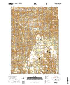
2020 Map of Big Rock Flat
USGS Topo · Published 2020About this map
Umatilla National Forest covers much of this high-plateau landscape in Morrow County, where a complex system of timber roads and canyons defines the drainage toward the Columbia River basin. The area is characterized by numerous seasonal and year-round water sources such as Opal Spring and Hollywood Spring, which were historically vital for livestock and forestry operations. High points like Opal Butte and Barlow Butte provide landmarks above the deep incisions of Rough Canyon and Davidson Canyon. The map reveals a land managed for its natural resources, evidenced by the network of Forest Development Roads and the presence of the Rough Canyon Reservoir. Large, relatively level areas like Big Rock Flat and Snowshoe Flat interrupt the series of ridges and hollows, including Pine Hollow and Hothole Ridge, offering a clear view of the topographic character of the Blue Mountains' western reaches.
Find a feature on this map
75 named features on this map. Tap any name to fly to it.
Don’t see what you’re looking for? This feature index may not catch every label — zoom into the map to look around manually.
Map Details
Editions of this 2020 Big Rock Flat Map
This is the sole edition of this map. No revisions or reprints were ever made.
Other maps of this area

1951 · Monument
USGS Topo · 1:62,500

1953 · Kimberly
USGS Topo · 1:62,500

1953 · Pendleton
USGS Topo · 1:250,000

1955 · Canyon City
USGS Topo · 1:250,000

1956 · Pendleton
USGS Topo · 1:250,000

1959 · Canyon City
USGS Topo · 1:250,000

1969 · Summerfield Ridge
USGS Topo · 1:24,000

1969 · Chapin Creek
USGS Topo · 1:24,000

1969 · Madison Butte
USGS Topo · 1:24,000

1969 · Hardman
USGS Topo · 1:24,000