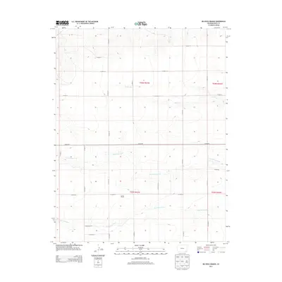
2013 Map of Big Rock Grange
USGS Topo · Published 2013About this map
Big Rock Grange stands as a focal point in this high plains landscape of southeastern Colorado, where the grid of the Public Land Survey System dictates the movement of people and commerce. The terrain is defined by the intermittent drainage patterns of Sand Creek, North Horse Creek, and South Horse Creek, which carve subtle paths across the prairie. This 2013 survey by the U.S. Geological Survey illustrates the intersection of Township 28 South and Township 29 South, where a precise network of county roads, including Co Road RR and Co Road 20, serves the rural agricultural community. The map provides a clear record of the area's infrastructure, showing how local transit is organized around the section lines of the wide-open Baca County plains.
Find a feature on this map
23 named features on this map. Tap any name to fly to it.
Don’t see what you’re looking for? This feature index may not catch every label — zoom into the map to look around manually.
Map Details
Editions of this 2013 Big Rock Grange Map
This is the sole edition of this map. No revisions or reprints were ever made.
Other maps of this area

1891 · Springfield
USGS Topo · 1:125,000

1892 · Two Butte
USGS Topo · 1:125,000

1893 · Two Butte
USGS Topo · 1:125,000

1893 · Springfield
USGS Topo · 1:125,000

1955 · La Junta
USGS Topo · 1:250,000

1958 · La Junta
USGS Topo · 1:250,000

1968 · La Junta
USGS Topo · 1:250,000
1971 · Big Rock Grange
USGS Topo · 1:24,000
1971 · Horse Creek Springs
USGS Topo · 1:24,000
1971 · Mc Endree Ranch
USGS Topo · 1:24,000