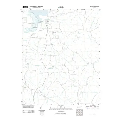
2010 Map of Big Sandy
USGS Topo · Published 2010About this map
Kentucky Lake and the Big Sandy River define this West Tennessee landscape, where the town of Big Sandy sits at the confluence of several vital waterways. The map documents a rural network of family and community landmarks, particularly evidenced by the numerous burial grounds like Sugar Creek Cemetery, Ramble Creek Cemetery, and Weatherly Cemetery that dot the hillsides. The infrastructure along the water, including the Big Sandy Dock and the Big Sandy River Dewatering Area, reflects the long-standing importance of the river to the local economy and navigation. Farther inland, the terrain is carved by a dense web of creeks and branches, such as Ramble Creek, Sulphur Creek, and Rushing Creek, which shaped the early settlement patterns and road placements. Cultural cornerstones like Bakers Chapel Church remain prominent in the interior, anchoring the communities that have farmed these drainages for generations.
Find a feature on this map
76 named features on this map. Tap any name to fly to it.
Don’t see what you’re looking for? This feature index may not catch every label — zoom into the map to look around manually.
Map Details
Editions of this 2010 Big Sandy Map
This is the sole edition of this map. No revisions or reprints were ever made.
Other maps of this area

1936 · Poplar Creek
USGS Topo · 1:24,000

1936 · McKinnon
USGS Topo · 1:24,000

1936 · Camden
USGS Topo · 1:24,000

1936 · Big Sandy
USGS Topo · 1:24,000

1936 · Johnsonville
USGS Topo · 1:24,000

1936 · Bruceton
USGS Topo · 1:24,000

1936 · Harmon Creek
USGS Topo · 1:24,000

1936 · Manleyville
USGS Topo · 1:24,000

1936 · Springville
USGS Topo · 1:24,000

1938 · Springville
USGS Topo · 1:24,000